Select menu: Spread | Sheet | Setup GIS Columns
In an ArcGIS shape file, there are a range of spatial objects that can be stored. For each spatial type there are a set of properties that must be associated with a particular column in the Genstat spreadsheet. Non spatial data is saved in an associated dBase (DBF) file.
- After you have imported your data, from the menu select
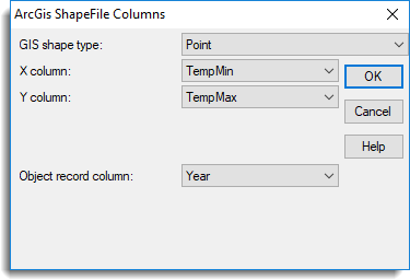
Spread | Sheet | Setup GIS Columns
OR
Stats | Spatial Analysis | Setup GIS Columns. - Fill in the fields as required then click OK.
The spatial objects types and the properties that must be specified for each type are outlined below. If a spreadsheet has been read in from a ArcGIS file the object type and column associations will already be defined.
All of the object types have the basic two spatial columns X and Y positions specifying two variate containing the horizontal and vertical (or easting and northing respectively) co-ordinates of the points in the object. The X column and Y column dropdown lists selects the variate containing the X and Y spatial information respectively.
All of the 3D object types have a third spatial column, Z, specifying the height of the point. The Z column dropdown list selects the variate containing the Z spatial information.
All of the 3D and Measure object types have a column, M, specifying the value of a particular measure at each the point. For example, this could be some attribute like soil moisture or temperature that varies continuously over the objects. The Measure column dropdown list selects the variate containing the M measure information.
For objects containing multiple points, a factor needs to be specified that indicates which object a particular point (or equivalently row) belongs to. The Object record column dropdown list selects the factor containing the information on which object a point belongs.
The object types and any extra information required on them is given below.
Point
A single point.
The Object record column factor is not required as each point must belong to a distinct object, but if specified, this will control the order that the points are added to the GIS file. Thus no other columns apart from the standard X and Y columns are required.
Multipoint
A set of points.
| Point order column | A factor may be provided which specifies the ordering of points within the set. This is not required, as if it is not specified, the current ordering of rows within the spreadsheet will be used. |
PolyLine
A set of line segments created by joining one point to the next. There may be multiple branches to the PolyLine. The separate parts are indexed with a factor.
| Part within object column | A factor may be provided which specifies the branches within the PolyLine. This is not required, as if it is not specified each PolyLine will consist of just one part. |
| Point order column | A factor may be provided which specifies the ordering of points within the set. This is not required, as if it is not specified, the current ordering of rows within the spreadsheet will be used. |
Polygon (region)
A region created by joining one point to the next to create a polygon (i.e. the points define the vertices of the polygon). The final point within a polygon must be the same as the starting point to ensure closure of the polygon. There may be multiple polygons/parts to the region. The separate parts are indexed with a factor.
| Part within object column | A factor may be provided which specifies the sub-polygons within the region. This is not required, as if it is not specified each region will consist of just one polygon. |
| Point order column | A factor may be provided which specifies the ordering of points around the outside of the polygon. This is not required, as if it is not specified, the current ordering of rows within the spreadsheet will be used. |
Point with measure
A single point with a measurement on it.
The Object record column factor is not required as each point must belong to a distinct object, but if specified, this will control the order that the points are added to the GIS file.
Multipoint with measure
A set of points with a measurements on each one.
| Point list | A factor may be provided which specifies the ordering of points within the set. This is not required, as if it is not specified, the current ordering of rows within the spreadsheet will be used. |
PolyLine with Measure
A set of line segments created by joining one point to the next with a measurement on each point. There may be multiple branches to the PolyLine with Measure. The separate parts are indexed with a factor.
| Part within object column | A factor may be provided which specifies the branches within the PolyLine. This is not required, as if it is not specified each PolyLine will consist of just one part. |
| Part order column | A factor may be provided which specifies the ordering of points within the set. This is not required, as if it is not specified, the current ordering of rows within the spreadsheet will be used. |
Polygon with measure
A region created by joining one point to the next to create a polygon (i.e. the points define the vertices of the polygon). A measurement is defined on each vertex of the polygon. The final point within a polygon must be the same as the starting point to ensure closure of the polygon. There may be multiple polygons/parts to the region. The separate parts are indexed with a factor.
| Part within object column | A factor may be provided which specifies the sub-polygons within the region. This is not required, as if it is not specified each region will consist of just one polygon. |
| Part order column | A factor may be provided which specifies the ordering of points around the outside of the polygon. This is not required, as if it is not specified, the current ordering of rows within the spreadsheet will be used. |
3D point
A single 3D point with a measurement on it.
The Object record column factor is not required as each point must belong to a distinct object, but if specified, this will control the order that the points are added to the GIS file. Thus no other columns apart from the standard X and Y columns are required.
3D multipoint
A set of 3D points with an optional measurement on it. The measure is optional and so Measure column need not be defined.
| Part order column | A factor may be provided which specifies the ordering of points within the set. This is not required, as if it is not specified, the current ordering of rows within the spreadsheet will be used. |
3D polyLine
A set of 3D line segments created by joining one 3D point to the next with an optional measurement on each point. There may be multiple branches to the PolyLine with Measure. The separate parts are indexed with a factor. The measure is optional and so Measure column need not be defined.
| Part within object column | A factor may be provided which specifies the branches within the 3D PolyLine. This is not required, as if it is not specified each 3D PolyLine will consist of just one part. |
| Part order column | A factor may be provided which specifies the ordering of points within the set. This is not required, as if it is not specified, the current ordering of rows within the spreadsheet will be used. |
3D polygon
A region created by joining one point to the next to create a polygon (i.e. the points define the vertices of the polygon). An optional measurement is defined on each vertex of the polygon. The final point within a polygon must be the same as the starting point to ensure closure of the polygon. There may be multiple polygons/parts to the region. The separate parts are indexed with a factor. The measure is optional and so Measure column need not be defined.
| Part within object column | A factor may be provided which specifies the sub-polygons within the region. This is not required, as if it is not specified each region will consist of just one polygon. |
| Part order column | A factor may be provided which specifies the ordering of points around the outside of the polygon. This is not required, as if it is not specified, the current ordering of rows within the spreadsheet will be used. |
MultiPatch
A region created by joining one point to the next to create a various shapes, called patches, which combine to define a region of coverage. There are 6 types of patches (specified below). An optional measurement is defined on each point. There may be multiple patches/parts to the region. The separate parts are indexed with a factor. The height/Z dimension is optional and so Z column need not be defined. The measure is optional and so Measure column need not be defined.
|
Part within |
A factor may be provided which specifies the sub-polygons within the region. This is not required, as if it is not specified each region will consist of just one polygon. |
| Part order column | A factor may be provided which specifies the ordering of points in each patch. This is not required, as if it is not specified, the current ordering of rows within the spreadsheet will be used. |
| Patch type column | A factor must be provided which specifies the patch type of each patch. |
The types of patches are:
| 0 | Triangle Strip |
| 1 | Triangle Fan |
| 2 | Outer Ring |
| 3 | Inner Ring |
| 4 | First Ring |
| 5 | Ring |
Further details about ArcGIS objects can be found at: http://www.esri.com/library/whitepapers/pdfs/shapefile.pdf
See also
Understanding Factors within a Spreadsheet
Import or Export Data
Import Data from Excel
Save Spreadsheet as a Text File
Save to Rich Text Format/HTML Options
Spreadsheet Sheet Menu